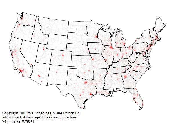
Land developability is a measure of land availability for future conversion and development in a geographic entity, such as a state, a county, a city, a census tract, or other geographically aggregated units.
The land developability index is generated using spatial overlay methods based on data layers of surface water, wetland, federal/state-owned land, Indian reservation, built-up land, and steep slope, which are all seen as undevelopable. The land developability index can be used for regression modeling when land use and development is a consideration of an analysis, for detecting potentials for land conversion and development, and for predicting the direction of future land use and development.
WebGIS
Data download: The land developability at the county and state levels [Excel file] [shapefile]
Citation: Chi, Guangqing, and Hung Chak Ho. 2020. "Land Developability." https://doi.org/10.7910/DVN/AMZMWH. Released on February 10, 2020.
References:
Chi, Guangqing and Hung Chak Ho. 2018. "Population Stress: A Spatiotemporal Analysis of Population Change and Land Development at the County Level in the Continental United States, 2000–2010." Land Use Policy 70(1): 128–137.
Chi, Guangqing. 2010. "Land Developability: Developing an Index of Land Use and Development for Population Research." Journal of Maps 2010: 609–617.
Background
Growth and development are limited by the potential for land conversion and development. The developability of lands in a place or region is determined by a variety of factors, including geophysical characteristics, the extent of built-up lands, cultural and aesthetical resources, and legal constraints. When studying these factors’ collective effects on growth and development, two approaches have been used. The first is to use these factors as explanatory variables in statistical analysis. However, doing so could double (or triple) count some land covers. For example, one piece of land could fall into a national park (public land) and be covered by water (not suitable for development); therefore, that piece of land would be double counted in the two variables. The other approach is to aggregate them into one or more indices by factor analysis or other statistics-based weighted aggregation methods. However, such generated indices provide only a relative rank of land developability across geographic units and cannot provide an estimate of the amount of lands available for development.
A more accurate estimate of the total lands available for development (called “land developability” in this project) can be estimated using a simple spatial model (e.g. spatial overlay methods in ArcGIS). Environmental analysts often employ spatial overlay methods to study the interactions between environment, population, land use, and legal constraints by overlaying these layers at fine pixel sizes.
Although social scientists may be interested in borrowing spatial overlay methods to study the relationship between land use and development and a social phenomenon of interest, the fact that social data are aggregated at rather coarse scales (mostly political or geographical areas) imposes difficulties in taking into account land use and development variables that generally can be studied usefully only at very fine data resolution. For example, geophysical factors such as elevation and slope likely influence housing development, but they can be measured meaningfully only at the pixel level of analysis.
This project proposes an approach for linking land use and development to social data by developing a spatial model. The model aggregates the layers of land use and development into a single raster layer representing developable lands. The layer of developable lands is then aggregated to political or geographical areas from which a developability index representing the proportion of lands available for development can be derived. The index can then be linked to social data for social science research.
Methodology
In general, the procedure for developing the land developability index involves the use of weighted spatial modeling and zoning statistics to identify developable lands at the 90-meter resolution and aggregation of the pixels to a geographic scale at which the developability index is produced. Weighted spatial modeling is used to sum up logical variables based on spatial ranking. Zonal statistics averages the values of pixels within each polygon’s boundary.
This methodology can be used for generating a land developability index for any unit of geography that is equal to or larger than the pixel sizes of the available data layers. These scales include metro/nonmetro areas, census tracts, congressional districts, block groups, zip codes, etc. For social science research, this methodology can be very useful for analysis involving sub-county units of geography, where the components of land conversion and development can be measured more meaningfully. The sub-county units of geography can include units within political boundaries, census-delineated boundaries, and boundaries defined for other purposes.
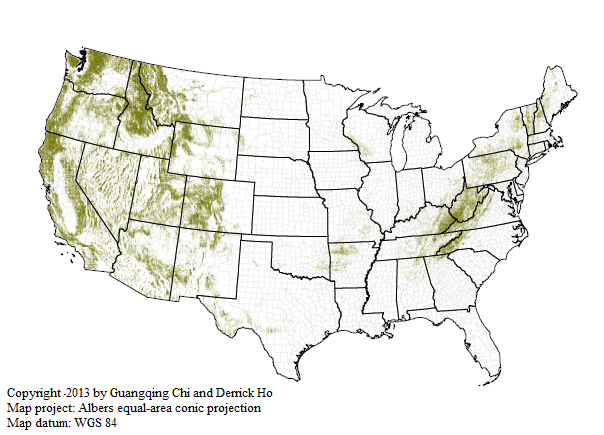
Data Elements: The land developability index is generated using spatial overlay methods based on data layers of surface water, wetland, federal/state-owned land, Indian reservation, built-up land, and steep slope, which are all seen as undevelopable. Below we address each of them.
Surface Water
Surface water is not suitable for building as a practical and legal matter as well as for the purposes of ecosystem protection and restoration. Surface water includes rivers, lakes, oceans, and ponds. The data for water in the continental United States are derived from the 2006 National Land Cover Database (NLCD), which is created with layers from multi-season Landsat imagery centered in the calendar year of 2006 on the basis of 65 mapping zones that cover the conterminous U.S. The 2006 NLCD categorizes the continental U.S. into 16 land cover classes at 30-meter pixel level. The surface water areas derived for this project are the pixels classified as open water, generally with less than 25% cover of vegetation or soil.
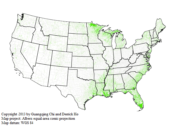
Wetland
Wetland is usually seen as not developable from both legal and geophysical perspectives. Wetland acts as a carbon sink and “natural purifier” of pollutions and is often legally restricted for development for protecting ecological systems purposes, as it is home to extinct species, protected species, and other species, as well as lives and activities related to federal/state environmental protection. In addition, the geophysical structure related to soil characteristics such as unstable soil make wetlands not suitable for development. The wetland data are extracted from a combination of the 2006 NLCD, the 2000 U.S. Geological Survey (USGS) Federal and Indian Lands, and the 1996 University of California-Santa Barbara (UCSB) Managed Areas Database (MAD). While the three sets of data layers overlap in many areas, they use different classifications. Thus, using a combination of the three data layers can provide an exhaustive coverage of wetland area.
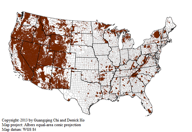
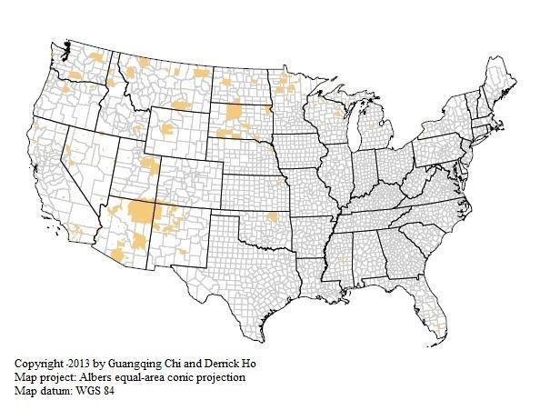
Federal and State Land
Publicly owned lands are usually not available for land development. Although they could be leased and used for residential or other-purpose land development, the magnitude is small. In this project, we consider federal and state lands including forests and parks, trails, wildlife refuges, and fishery areas. These lands are tax exempted and thus are legally protected lands. The data for federal- and state-owned lands are extracted from the 2000 USGS Federal and Indians Lands and the 1996 UCSB MAD.
Built-up land
Built-up land is not seen as developable in this project. Although existing built-up lands could be re-built vertically, the land developability index is considered horizontally in this project. Built-up lands are derived from the 2006 NLCD. The built-up lands considered in this project are those with impervious surfaces accounting for 20% or more of total land cover. These areas most commonly include single-family housing units, apartments, and commercial and industrial developments. It should be noted that suburban areas could be impervious as low as to 5–10% but are not developable. This should be considered in future research.
Steep Slope
A steep slope is difficult for residential development physically and often cannot pass legal requirements such as erosion control and stormwater management ordinances. Soils and bedrock in steep slopes are usually unstable and have a higher chance of experiencing natural hazards (e.g., landslides) and associated property damages than those in flatter ground and are more difficult for construction than flat ground. In this project, areas with slope greater than or equal to 20% are viewed as undevelopable. The slope layer is generated from the Digital Elevation Model (DEM) data of the Shuttle Radar Topography Mission (SRTM) Version 4.
Data Sources
|
|
Data Type |
Ground Sample size |
Acquisition Date |
Source |
|
National Land Cover Data (NLCD) |
Raster |
30 meter |
2006 |
Multi-Resolution Land Characteristics Consortium |
|
Federal and Indian Lands |
Vector (Polygon) |
- |
2000 |
U.S. Geological Survey |
|
Managed Areas Database |
Vector (Polygon) |
- |
1996 |
Remote Sensing Research Unit, University California-Santa Barbara |
|
SRTM DEM (Version 4) |
Raster |
90 meter |
2000 |
Consultative Group on International Agricultural Research-Consortium for Spatial Information (CGIAR-CSI) |
|
Cartography Boundary Files |
Vector (Polygon) |
- |
2010 |
U.S. Census Bureau |
Notes: there are other types of tax-exempt lands, such as cultural and aesthetic resources. However, such data for the entire continental United States are not georeferenced or digitally available and thus are not included in this analysis. Similarly, data for legal constraints of land use and development, such as land-use planning legislation and programs including comprehensive plans, “smart growth” laws, zoning ordinances, and farm land protection programs, environmental regulations such as the Clean Water Act, and shoreland and wetland zoning etc., are not available and therefore are not considered for this project. Because excluding these possible layers from the analysis overestimates land developability, the data unavailability for these tax-exempt layers is a limitation of this project. When such data become available, these variables should be included in analyses, as they would help improve the accuracy of land developability estimates.